UPDATE: Wednesday, January 12th, 2011
One Stop Shop (OSS) and WeatherShare are overlapping, but complementary websites. While WeatherShare is geared towards weather information only, One Stop Shop adds information such as camera images and sign messages. And, OSS provides coverage for Oregon, although weather information is only shown for California. It’s taken us a couple weeks to put this update together, but we wanted to show how these systems indicate severe weather and road conditions.
On December 21st and 22nd, there was a great deal of precipitation throughout California and Oregon. Here we’ve grabbed some screenshots to show magnitude of the storm, and the wealth of information available in WeatherShare and OSS. Click here to view an extended version of this update, including over 50 screenshots. (Note that this is a large file - 20 MB.)
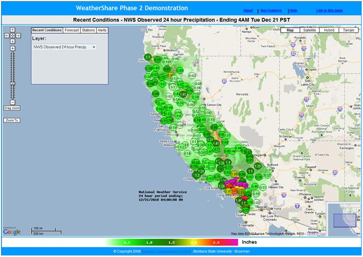
The NWS Observed 24 Hour Precipitation layer in WeatherShare (and OSS) shows estimated precipitation throughout California. Information from sensors and some complex models from the PRISM Group at Oregon State University are used to make these estimates. In the following image from WeatherShare, you’ll see a large amount of precipitation throughout the state, including very heavy precipitation in the Los Angeles area:
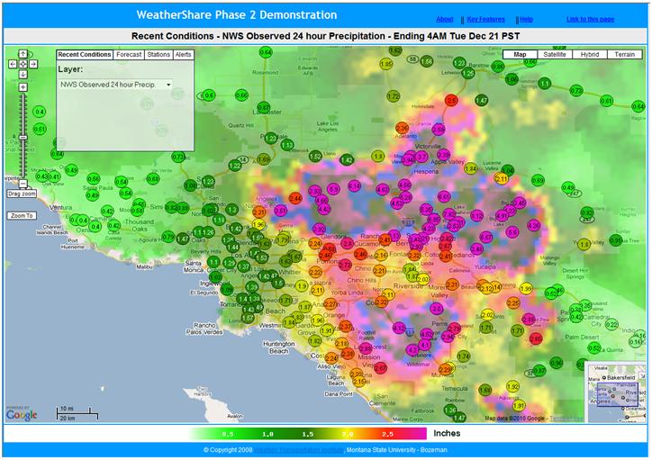
We zoomed in on the Los Angeles area and found values of over 4 inches (and more) from the past 24 hours:
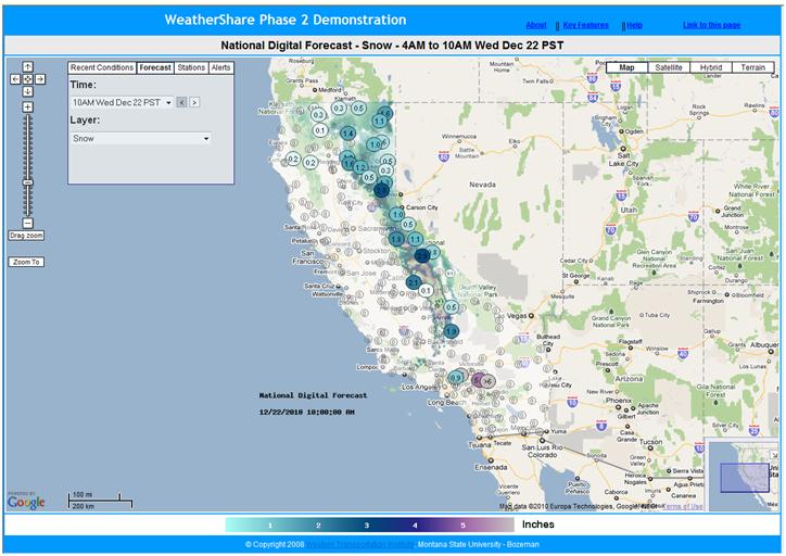
Not only are past and current weather information available in these systems, we also show forecasts using data from the National Weather Service’s National Digital Forecast Database (NDFD). Here is forecasted cumulative snow for a six hour period:
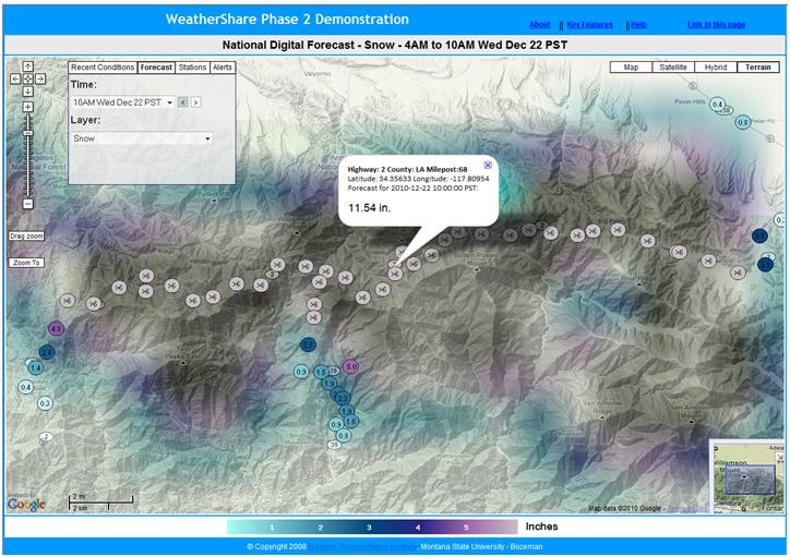
The forecasted amounts of snow were high in the mountains near Los Angeles. We zoom in for further detail and find the following location along Highway 2, which indicates over 11 inches of snow during this 6-hour period:
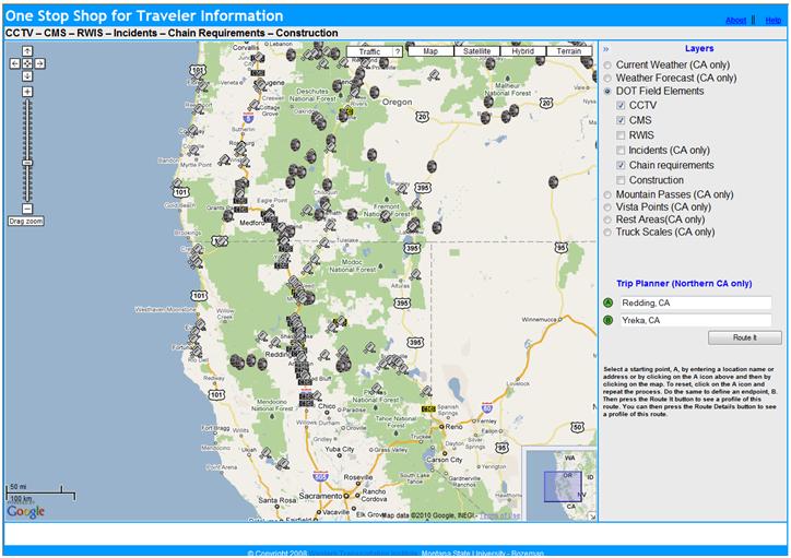
Now, let’s look at OSS. In the screenshot below from December 22nd, 2010, we’re looking at the DOT Field Elements layer and the CCTV, CMS and Chain Requirements sub-layers:
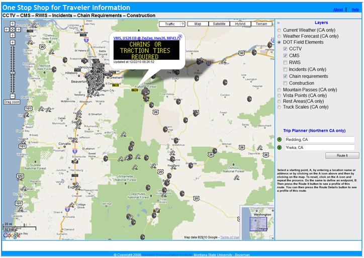
CMS were indicating chain and traction tire requirements in Oregon:
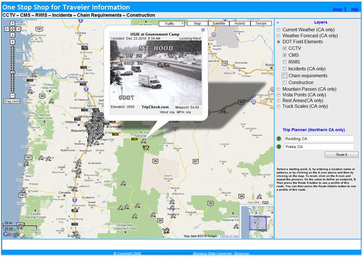
This CCTV image showed why:
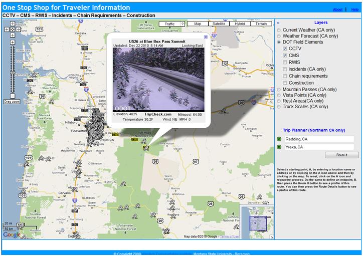
And there were plenty of similar images across Oregon and California at this time:
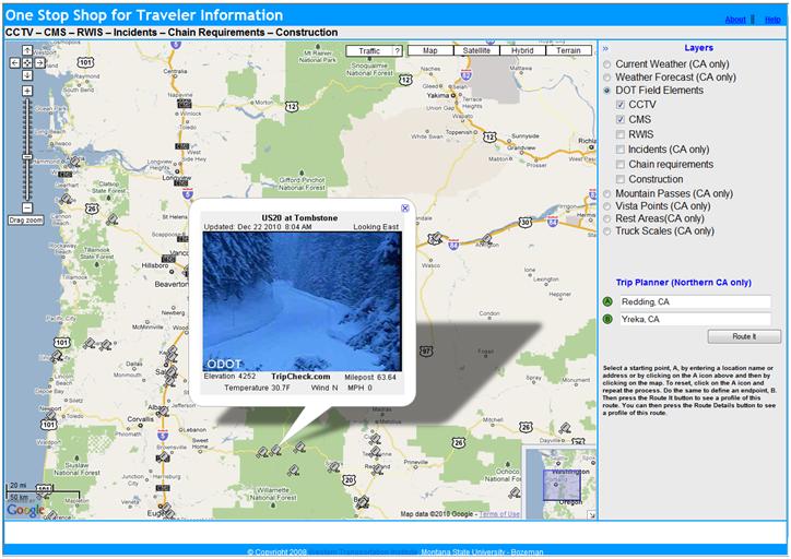
Here’s US 20 at Tombstone in Oregon:
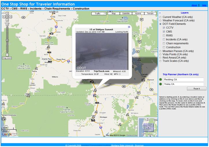
I-5 at Siskiyou Summit:
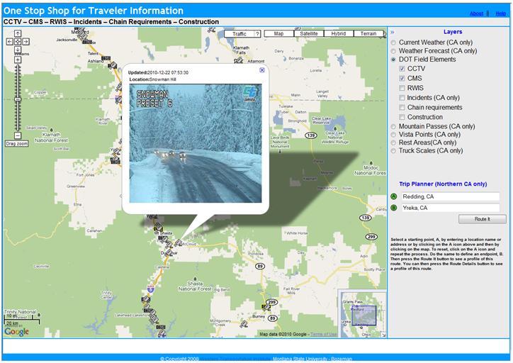
Snowman summit on SR-89 near Mt. Shasta:
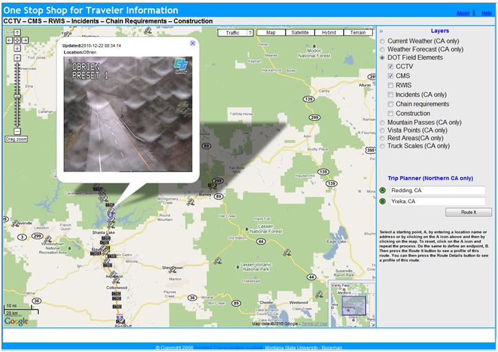
Obrien near Mt. Shasta shows rain rather than snow:
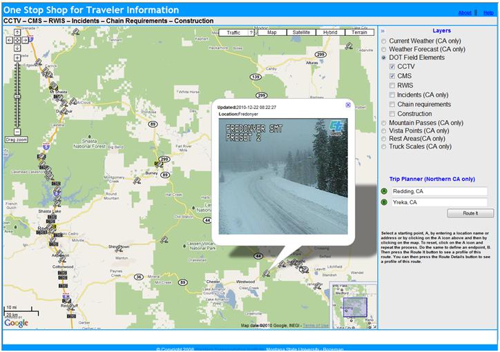
Fredonyer Summit west of Susanville:
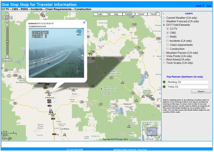
Here’s more rain along I-5 south of Redding:
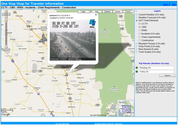
SR-99 near Fresno:
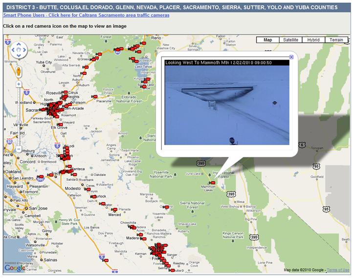
We currently don’t have CCTV images from all of California in OSS, but we plan to add more soon. Here are some images from Caltrans. This one is from US 395 near Mammoth. There was very heavy snow here at the time:
As you can see, these were eventful days in terms of weather. Keep an eye on the conditions using OSS and WeatherShare.
Click here to view an extended version of this update, including over 50 screenshots. (Note that this is a large file - 20 MB.)

