UPDATE: Tuesday, August 14th, 2018
Fire season is here again, and it is hitting close to home. The Carr Fire spread into Redding, California and caused a lot of damage. Our colleagues who work in the Caltrans District 2 Headquarters Building were told not to report to work on July 27th because the fire was very close to their building:
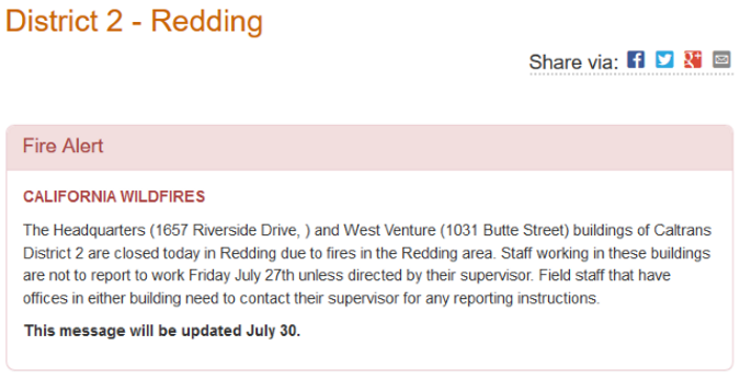
Source: Caltrans District 2 Home Page – http://www.dot.ca.gov/d2/
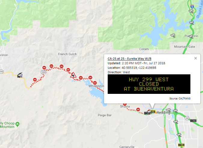
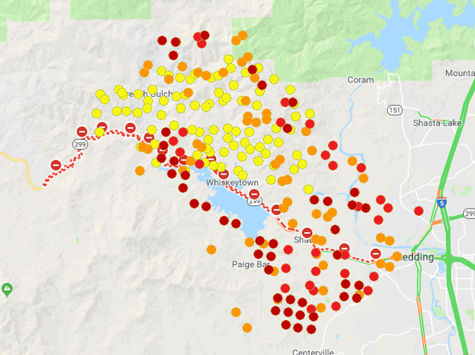
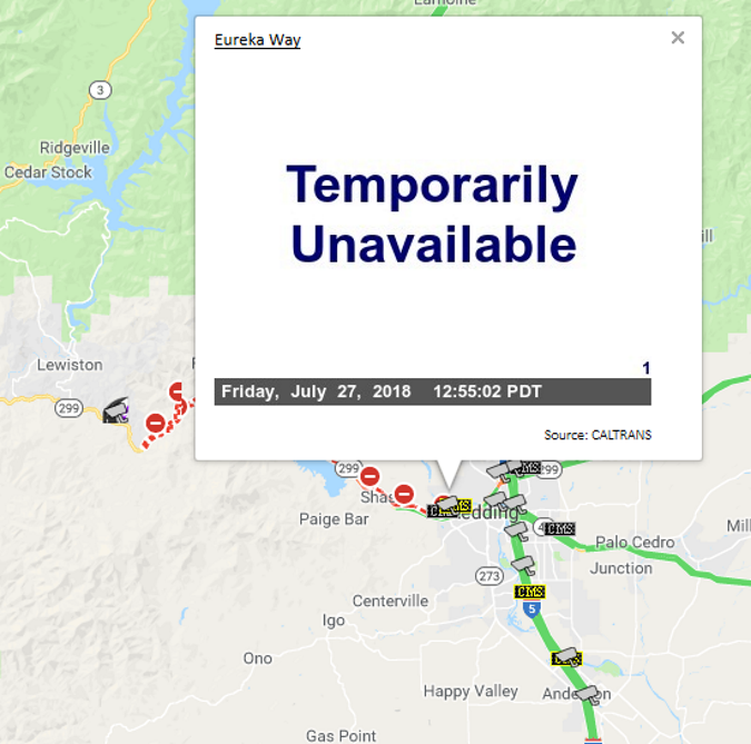
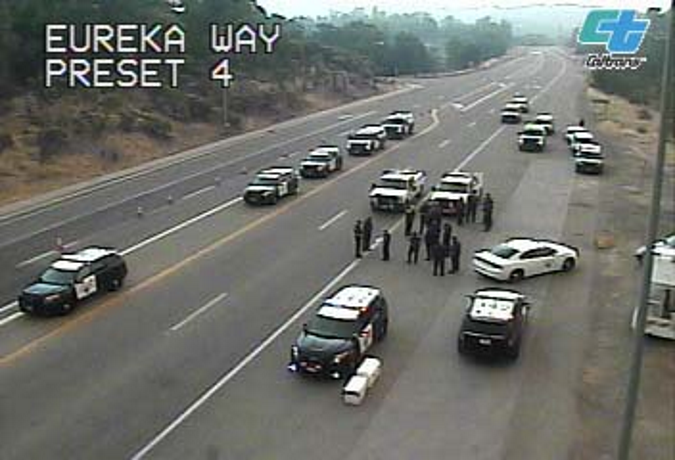
This fire and its impact can be seen in multiple ways in the One-Stop-Shop. State Route 299 was closed to the west of Redding. This was seen in the Google Maps Layer. There were also several CMS messages indicating the closure, along with at least one CHP incident. The Fire Detections layer shows the extent of the fire, which was within the city of Redding at one point. Unfortunately, the Eureka Way CCTV was not showing camera images. This outage was likely due to a power outage in proximity to the fire. One-Stop-Shop users were viewing this CCTV more than any other site July 26th until the outage occurred. Immediately prior to the outage, emergency responders could be seen gathering along the roadway.
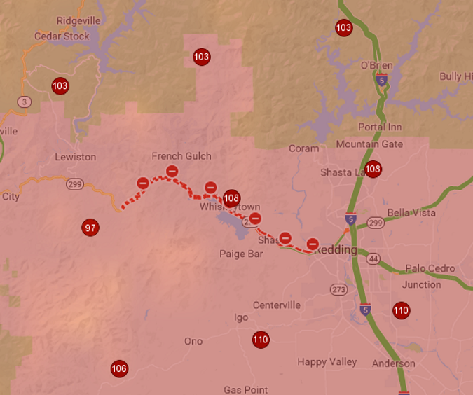
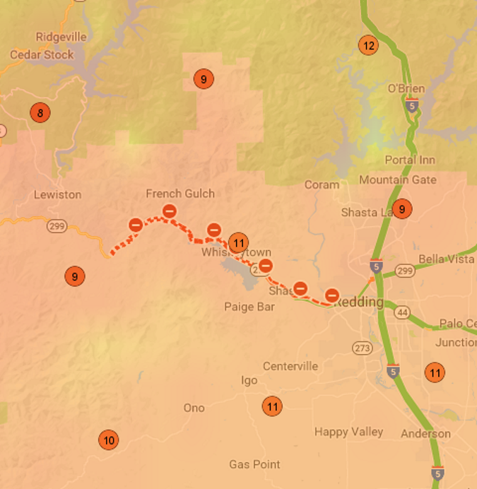
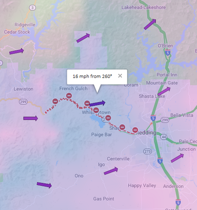
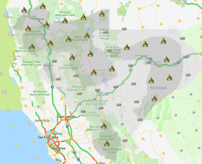
Unfortunately, the weather forecast for the next afternoon was of little help, with temperatures approaching 110° F, humidity near 10% and wind gusts of 16 mph. And, Smoke and haze will impact nearly all travel across Northern California and Nevada as well as Southern Oregon for some time to come.
SR-299 Closure and Associated CMS Message:
Fire detections near Redding, California:
Caltrans D2 Eureka Way CCTV was temporarily unavailable:
Emergency Responders gathered on SR-299 in Redding on 7/26/2018, as shown by Caltrans CCTV:
Temperatures were forecasted to be over 100° F on July 27th:
Humidity was forecasted to be quite low on the afternoon of July 27th. The screenshot shows forecast humidity between 8% and 12% for the area:
Wind gusts around 16 mph were forecasted for the afternoon of July 27th:
Smoke and haze were expected to cover large parts of Northern California, Nevada, and Southern Oregon:
NOTE: This update was written on the afternoon of July 27th, 2018. The Carr Fire had a devastating impact on Redding and the surrounding area on July 26th and July 27th. Much of the impact was still unknown at the time we wrote this.
Be sure to gather as much information as possible from OSS (http://oss.weathershare.org/), Mobile OSS (http://oss.weathershare.org/m) and all available sources before and during trips to plan for safe travel.
Check back soon for more OSS updates.

