One Stop Shop (OSS) Update - January 18th, 2012 - Part 1

ONE STOP SHOP HOME | ARCHIVED UPDATES


UPDATE: Wednesday, January 18th, 2012 - Part 1

Today is one of those days when a single update isn't enough. Winter has been slow in arriving, but it came in full force today across the four-state, Western States region. There is snow throughout the region and plenty of incidents to go with it. Be sure to take a look at multiple OSS updates from today.

Earlier today there was an accident involving a big rig and a tour bus north of Redding. I-5 was shut down awaiting clearance of the incident. This was apparent in OSS via the Road / Travel Conditions, Incidents layer.  Here's a portion of the CHP report from the incident:

OSS Screenshot (1/18/2012): A CHP incident report for a traffic accident along I-5 north of Redding.

OSS also showed the CMS message indicating the closure, which was also indicated through a chain control message:

OSS Screenshot (1/18/2012): CMS message stating "I-5 closed 6 miles ahead due to accident." OSS Screenshot (1/18/2012): Chain Control Message for closure along I-5.

Here's another CMS message indicating that the closure starts at Fawndale:

OSS Screenshot (1/18/2012): CMS message stating "I-5 closed at Fawndale due to accident."

And, here's a CCTV image at Fawndale. Look close and you can see vehicles waiting for the closure to end:
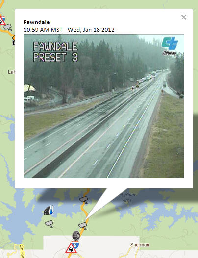
OSS Screenshot (1/18/2012): CCTV image behind the closure on I-5.

While it was raining at Fawndale, conditions were worse to the north, in proximity to the incident. Here's the camera at Vollmers showing alot of snow:
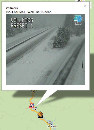
OSS Screenshot (1/18/2012): CCTV camera near Vollmers showing snow near the incident.

It is very easy to use OSS to walk along a route or through a region to get a quick glimpse at conditions. Here are camera images along I-5 from Shasta Lake to Ashland, Oregon. It's easy to see that travel would have been difficult at this time:

Pit River Bridge, Approaching Shasta Lake:
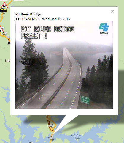
OSS Screenshot (1/18/2012): CCTV camera image showing Pit River Bridge, approaching Shasta Lake.

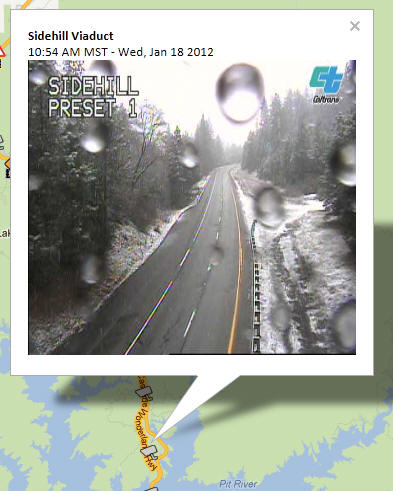
Sidehill Viaduct:

OSS Screenshot (1/18/2012): CCTV camera image showing road conditions near Sidehill Viaduct.

Obrien:

OSS Screenshot (1/18/2012): CCTV camera image showing road conditions near OBrien.

Salt Creek:

OSS Screenshot (1/18/2012): CCTV camera image showing road conditions near Salt Creek.

Sacramento Hill:

OSS Screenshot (1/18/2012): CCTV camera image showing road conditions near Sacramento Hill.

Antler's Bridge:

OSS Screenshot (1/18/2012): CCTV camera image showing road conditions near Antler's Bridge.

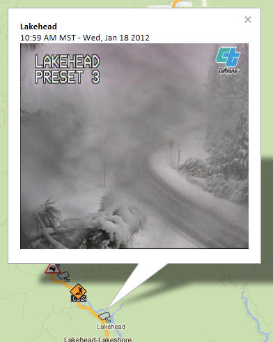
Lakehead:

OSS Screenshot (1/18/2012): CCTV camera image showing road conditions near Lakehead.

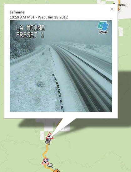
La Moine:

OSS Screenshot (1/18/2012): CCTV camera image showing road conditions near La Moine.

Sims Rd:

OSS Screenshot (1/18/2012): CCTV camera image showing road conditions near Sims Rd.

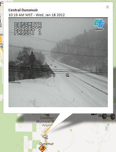
Dunsmuir:

OSS Screenshot (1/18/2012): CCTV camera image showing road conditions near Dunsmuir.

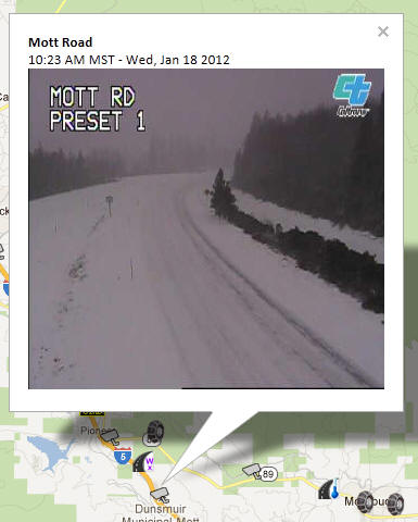
Mott Road:

OSS Screenshot (1/18/2012): CCTV camera image showing road conditions near Mott Road.

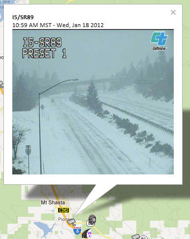
I-5 at SR-89:

OSS Screenshot (1/18/2012): CCTV camera image showing road conditions near I-5 at SR-89.

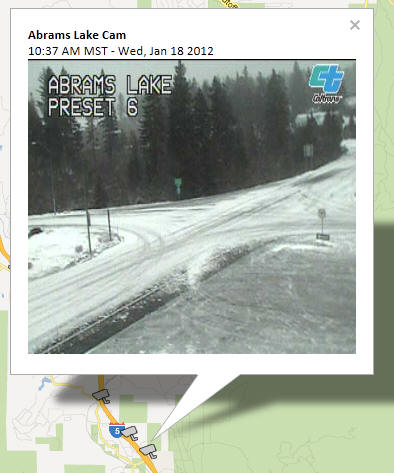
Abrams Lake:

OSS Screenshot (1/18/2012): CCTV camera image showing road conditions near Abrams Lake.

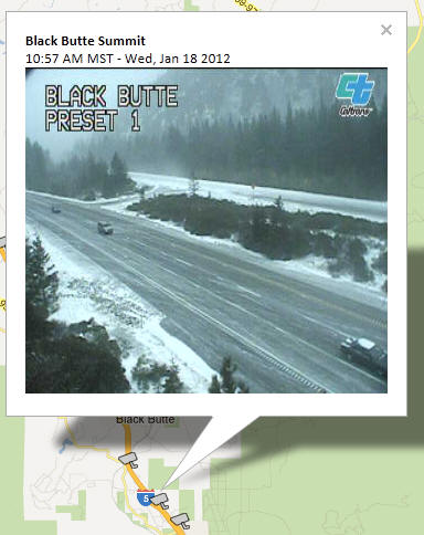
Black Butte Summit:

OSS Screenshot (1/18/2012): CCTV camera image showing road conditions near Black Butte Summit.

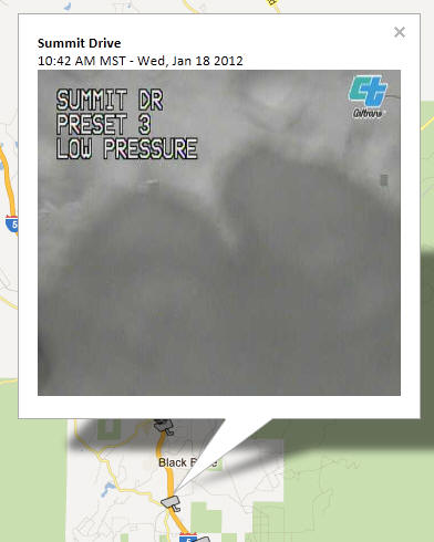
Summit Drive:

OSS Screenshot (1/18/2012): CCTV camera image showing road conditions near Summit Drive.

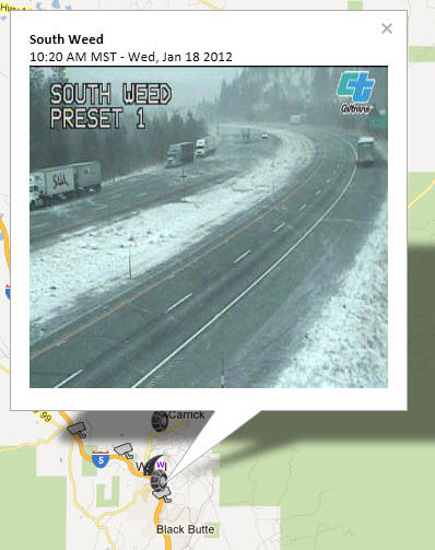
South Weed:

OSS Screenshot (1/18/2012): CCTV camera image showing road conditions near South Weed.

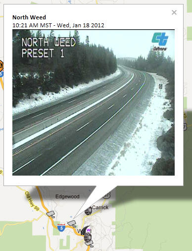
North Weed:

OSS Screenshot (1/18/2012): CCTV camera image showing road conditions near North Weed.

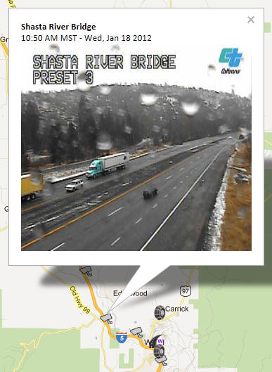
Shasta River Bridge:

OSS Screenshot (1/18/2012): CCTV camera image showing road conditions near Shasta River Bridge.

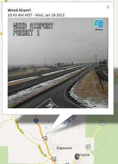
Weed Airport:

OSS Screenshot (1/18/2012): CCTV camera image showing road conditions near Weed Airport.

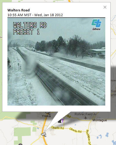
Walters Road:

OSS Screenshot (1/18/2012): CCTV camera image showing road conditions near Walters Road.

Central Yreka:

OSS Screenshot (1/18/2012): CCTV camera image showing road conditions near Central Yreka.

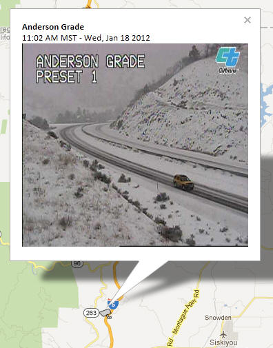
Anderson Grade:

OSS Screenshot (1/18/2012): CCTV camera image showing road conditions near Anderson Grade.

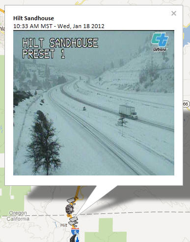
Hilt Sandhouse:

OSS Screenshot (1/18/2012): CCTV camera image showing road conditions near Hilt Sandhouse.

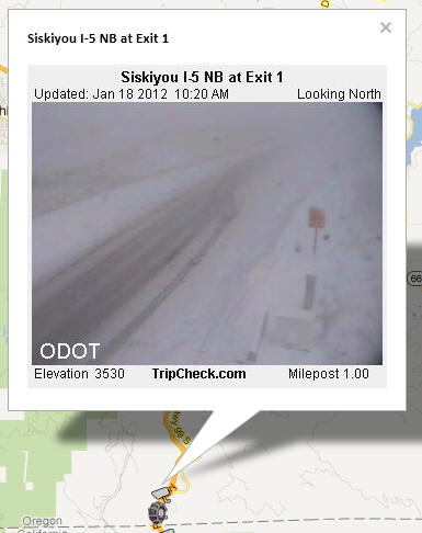
Siskiyou Pass:

OSS Screenshot (1/18/2012): CCTV camera image showing road conditions on I-5 NB at Exit 1 near Siskiyou Pass.

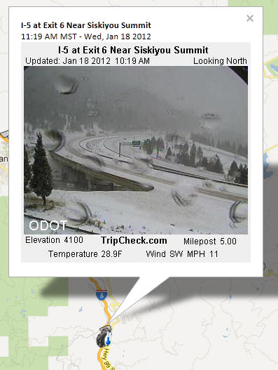
Siskiyou Pass:

OSS Screenshot (1/18/2012): CCTV camera image showing road conditions on I-5 at Exit 6 near Siskiyou Summit.

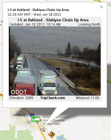
Ashland, OR:

OSS Screenshot (1/18/2012): CCTV camera image showing road conditions near Ashland, OR.

The CCTV images are perhaps the best visual when it comes to indicating conditions. Other layers can be informative too. We've include Google's Traffic layer as an experimental layer in OSS to give an indication of traffic flow. While we're still hesitant to recommend its use in terms of accuracy, timeliness and reliability, it does seem to give a good general indication of problem areas during large events such as today's snowfall. You'll notice that much of the are between Shasta Lake and Weed is color yellow or red, indicating slower speeds at about the same time as the incident:
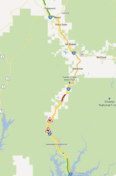
OSS Screenshot (1/18/2012): Google Traffic Layer - experimental - to show general traffic flow.

The display is similar in the Siskiyou Pass area:
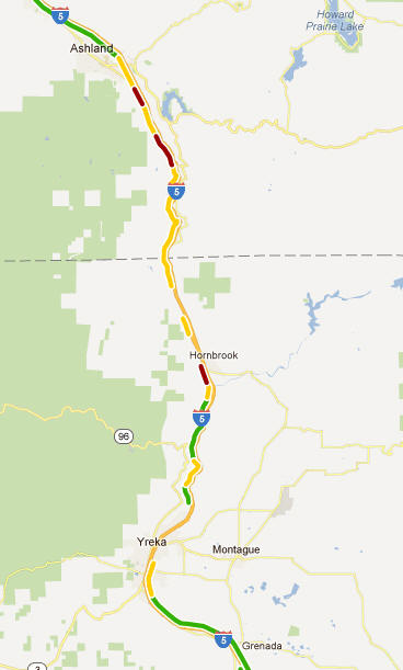
OSS Screenshot (1/18/2012): Google Traffic Layer - experimental - to show general traffic flow.

Again, be sure to take a look at multiple OSS updates from today, take a look OSS live at http://oss.weathershare.org/, and, gather as much information as possible from OSS and all available sources both before and while traveling to help plan for safe trips.

Updates from today:

One Stop Shop (OSS) Update - January 18th, 2012 - Part 1 (above)
One Stop Shop (OSS) Update - January 18th, 2012 - Part 2
One Stop Shop (OSS) Update - January 18th, 2012 - Part 3
One Stop Shop (OSS) Update - January 18th, 2012 - Part 4


TOP